Discoveries
DiscoVereto 2026, from the hill to the sea: new discoveries at Vereto and San Gregorio, and a new history for the Centopietre and the forgotten relic of the Baptist
For more information, watch the press conference again
Ten weeks of excavation made it possible to follow the history of Vereto from its first protohistoric occupation to Late Antiquity, and to return to investigate its ancient landing place at San Gregorio. The research also extended to the way the memory of the territory was built: documents, monuments and traditions now make it possible to trace, with considerable confidence, a relic of St John the Baptist once venerated in Patù to Altamura, and to propose a new reading of the origins of the legend of Siminiano and of the Centopietre.
With the end of the second excavation campaign on 2 October, the first great season of DiscoVereto comes to a close. DiscoVereto is the archaeological research programme of the University of Naples “L’Orientale”, under the scientific direction of Valentino Nizzo, with topographic work coordinated by Dr Angela Bosco (University of Naples L’Orientale) in collaboration with Dr Rosario Valentini of the University’s BIMA Centre. The project is carried out under a concession from the Ministry of Culture and under the supervision of the Soprintendenza Archeologia, Belle Arti e Paesaggio for the provinces of Brindisi, Lecce and Taranto.
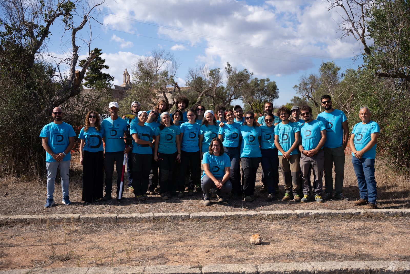
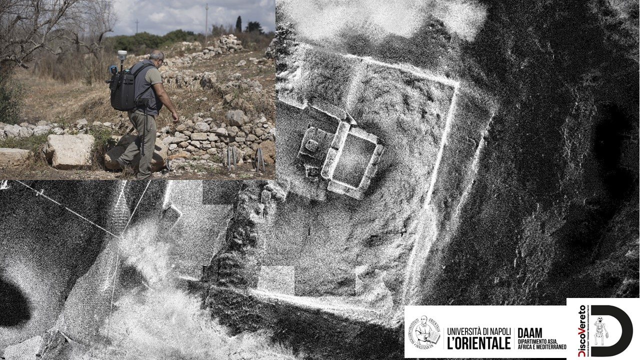
From 18 May to 2 October 2026, with a break over the summer months, the two campaigns involved students, archaeologists and specialists for a total of ten weeks, first on the hill of ancient Vereto and then also at San Gregorio, its landing place on the Ionian Sea. Fieldwork was coordinated by the professional archaeologist Alessandro Rizzo, under the scientific direction of Valentino Nizzo and with the collaboration of Michele Bonfrate; the underwater archaeologist Dr Angelo Cossa took part in the underwater surveys and recoveries. Over the two campaigns more than 40 students from the University of Naples L’Orientale and other Italian universities took part in the research, turning the site into an intensive place of university training as well. The topographic and digital documentation, coordinated by Angela Bosco with the collaboration of Rosario Valentini, combined high-precision surveys with tools for the digital and three-dimensional reconstruction of the archaeological evidence.
The research was made possible by the initiative of the Municipality of Patù, which promoted the project locally and allocated to the archaeological work first resources from the PNRR Storie Meridiane project and then those of the regional SMART-In programme, within the project “The Ionian coast between Greeks and natives: Torre San Gregorio, landing place of Vereto”.
The most important result is not a single find, but the chance to begin reconstructing the long history of Vereto, following every trace preserved in the ground without selecting in advance: from the most recent phases of the Roman and Late Antique settlement back to the Messapian city, the Archaic period and the first protohistoric occupation.
Vereto: beneath the Roman town, traces of the earliest occupation
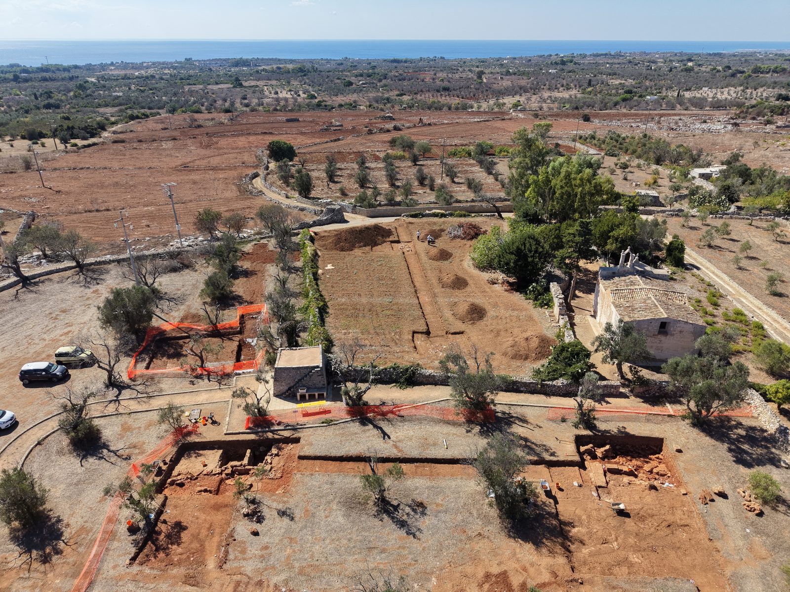
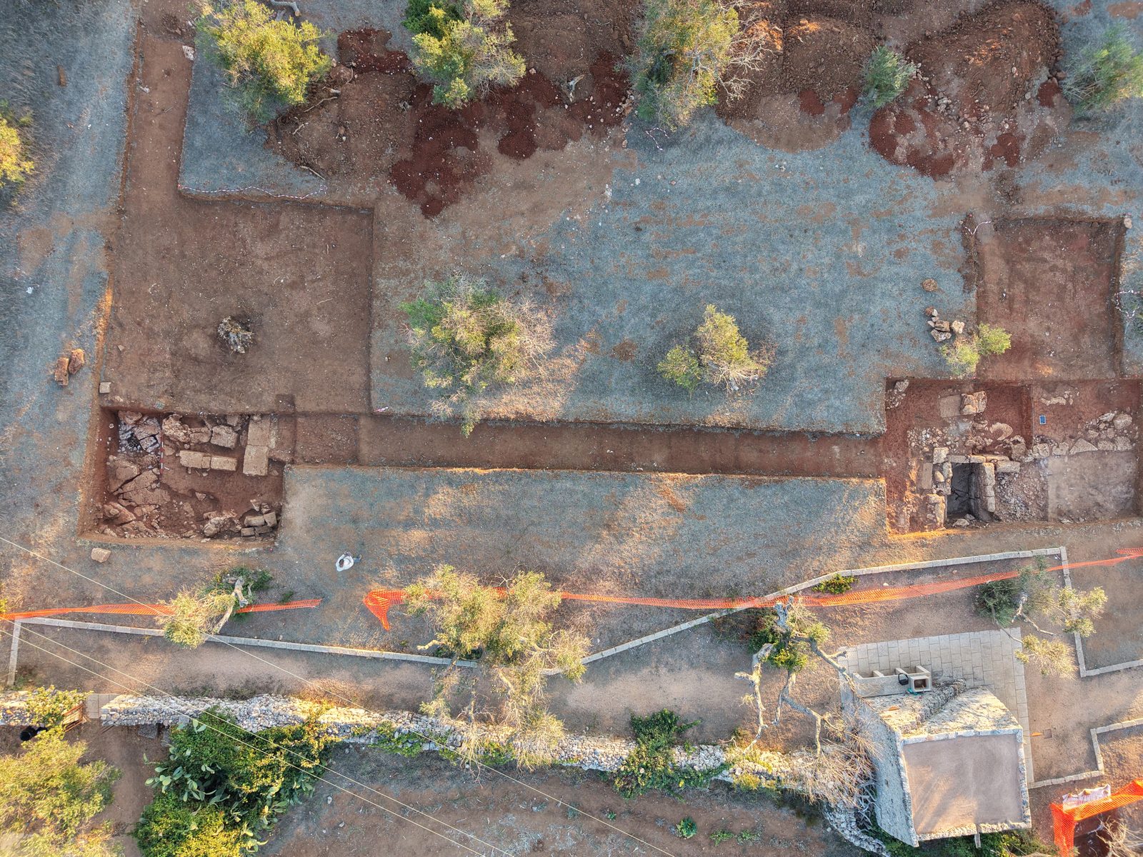
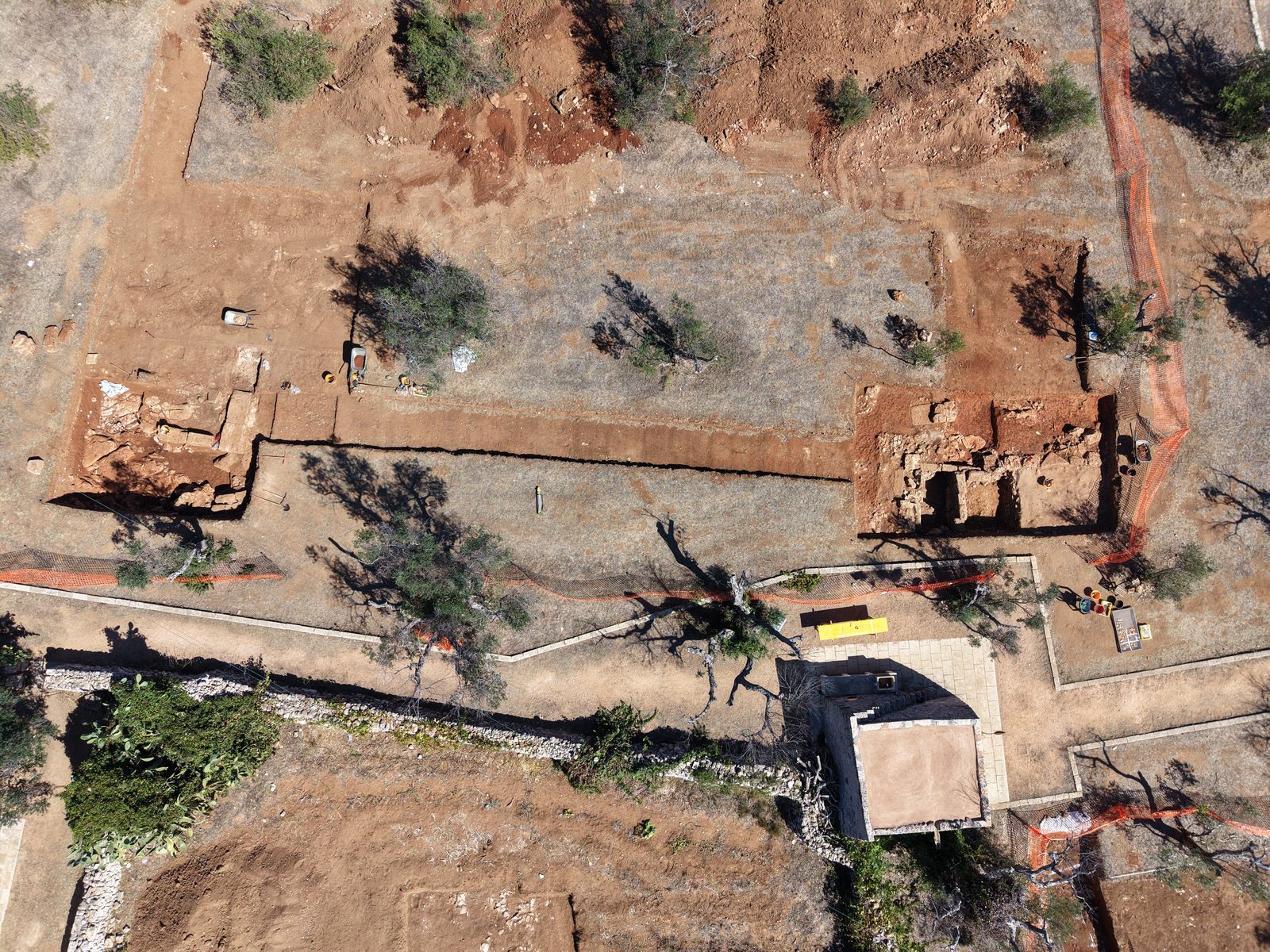
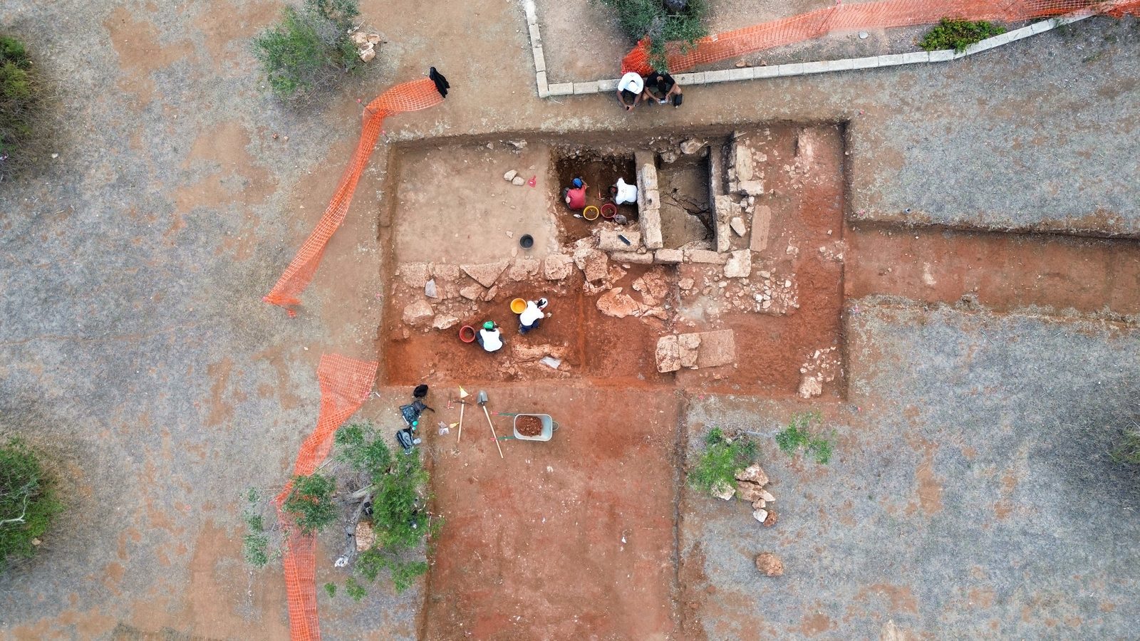
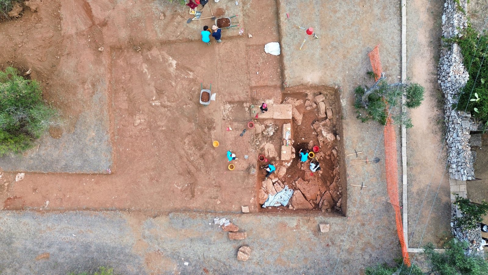
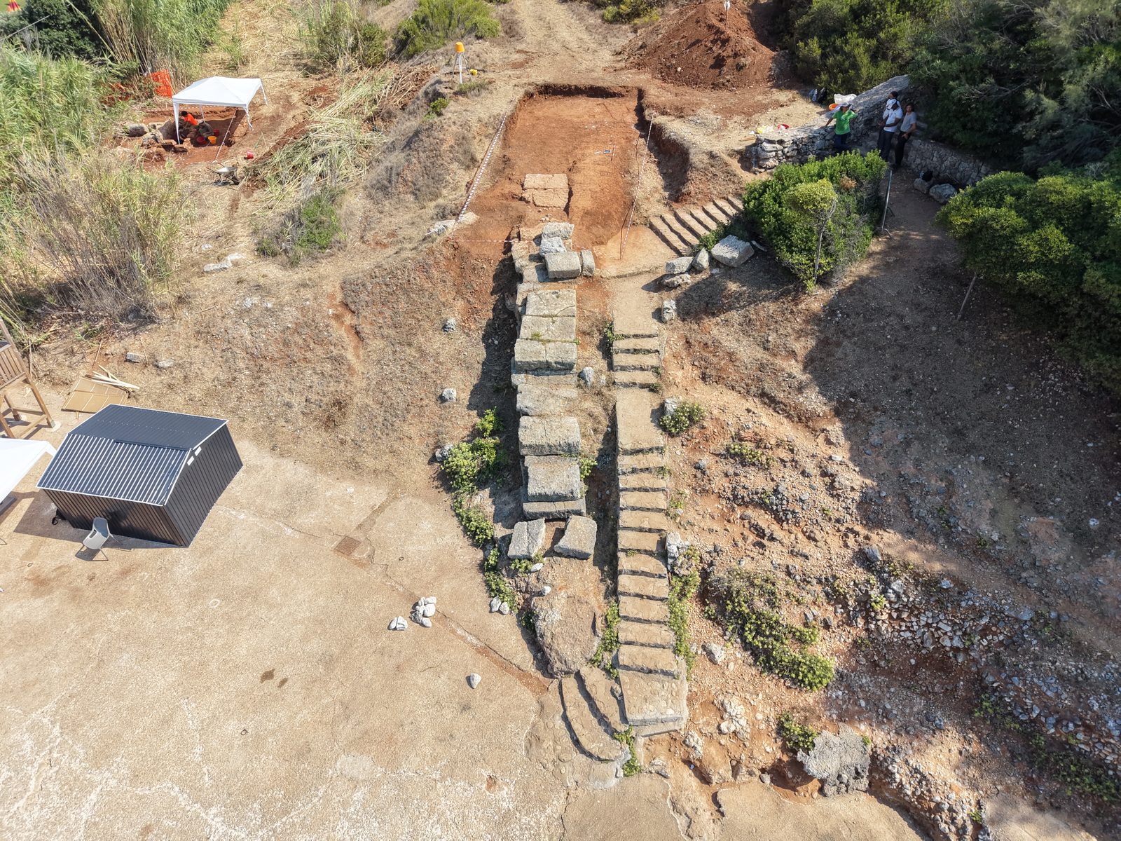
On the summit of the hill, the investigations resumed and enlarged the areas opened during the first campaign, extending also into the land south of the church of the Madonna di Vereto.
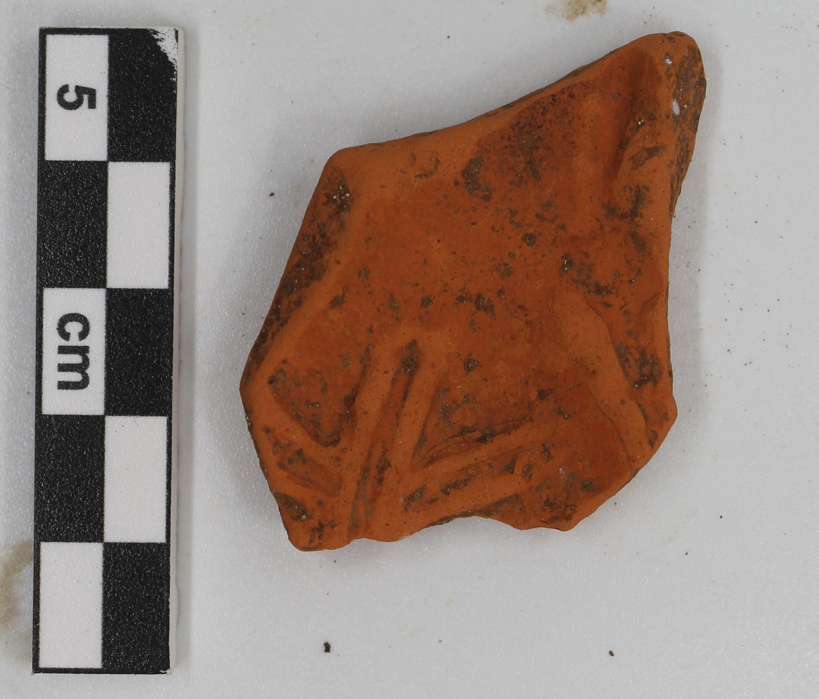
The uppermost levels bear witness to the profound transformations the site underwent in modern times because of farming, the building of terraces and the later robbing of the ancient structures. Even these layers, however, yielded significant material: fragments of Roman and pre-Roman pottery, bronze coins, metal objects, a brooch and even a fragment of Egyptian blue, found in the ploughsoil and therefore out of its original context.
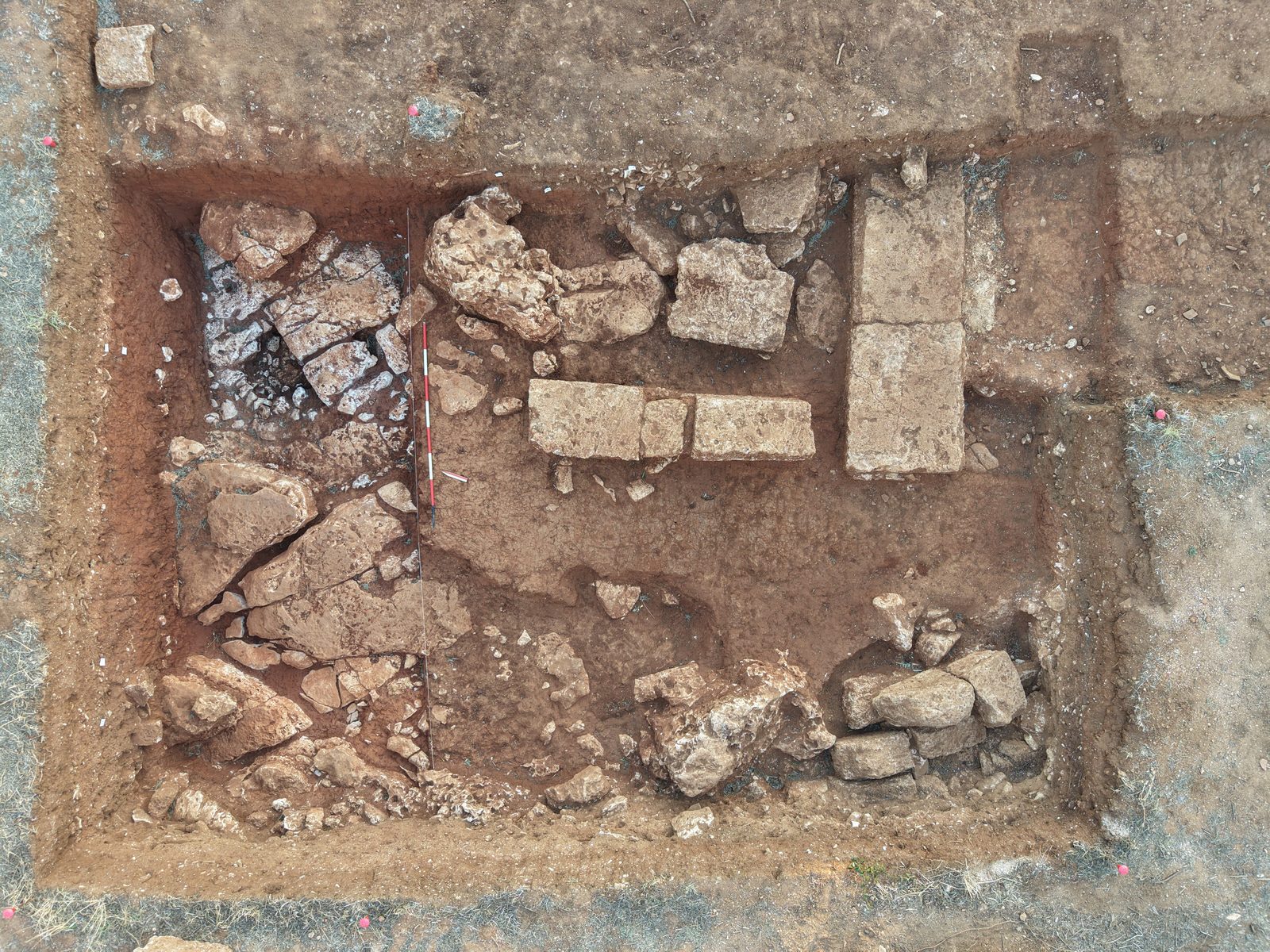
Enlarging the trenches also made it possible to identify walls of rubble and calcarenite, built surfaces and, above all, the traces left by the systematic robbing of the ancient buildings. A large structure built of blocks, already identified in the first campaign, had in fact been partly erased by a trench dug to recover and rework the building material. Beneath these interventions the bedrock shows extensive traces of artificial levelling, carried out to create regular surfaces and foundations for the structures.
It was in the hollows of the rock that one of the most evocative finds of the campaign came to light. A semicircular arrangement of stones, some clearly exposed to fire, enclosed soil rich in charcoal, burnt animal bones and impasto pottery, including the restorable base of a cooking pot. The whole has been preliminarily interpreted as a hearth belonging to the earliest phases of occupation of the area, between the end of the Bronze Age and the Early Iron Age. Detailed study of the finds will make it possible to refine its date.
This evidence further extends the historical depth already suggested by the first campaign, and confirms how important it is to investigate the whole hill stratigraphically, without limiting research to the monumental phase of the Messapian city.
The last centuries of the town
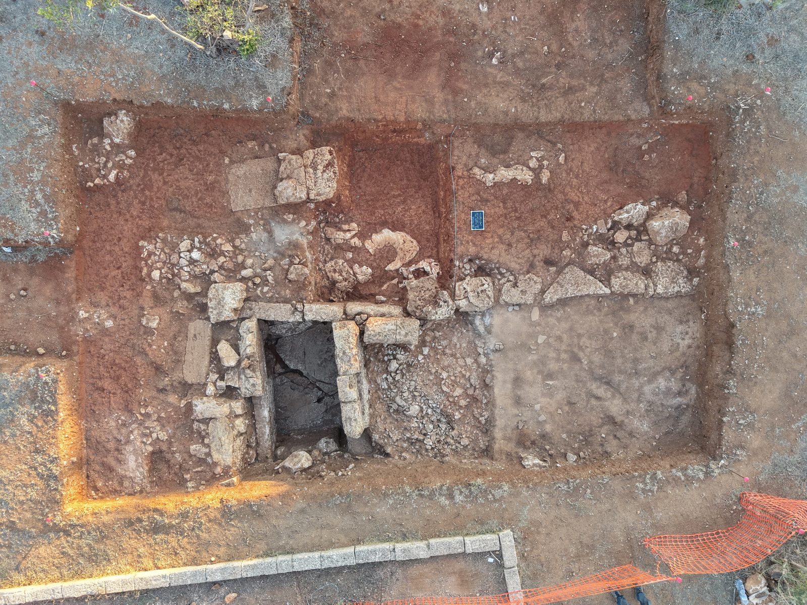
The same chronological depth emerges from the rooms already uncovered during the May–June campaign. The excavation made it possible to distinguish successive phases of use, transformation and abandonment.
In one of the rooms, levels interpreted as dumps of household waste were identified, with animal bones, shells, ash, charcoal and plenty of Late Roman pottery. The floor was the carefully levelled bedrock itself. A Hellenistic bow brooch, found in a residual position inside a later wall, is a further sign of pre-Roman occupation of the area.
In the adjacent room two distinct beaten-earth floors were identified. The older one lay on an elaborate rubble foundation built to insulate and drain, made up of three superimposed layers. In this sector the excavation has not yet reached the natural subsoil: the archaeological sequence therefore continues further down and remains one of the areas to be resumed in future campaigns.
These data help to give archaeological substance to the last centuries of Vereto. The town did not disappear suddenly with the Roman conquest, but kept changing for centuries, down to Late Antiquity, as older buildings were altered, demolished, robbed and reused. The discovery, already made in the first campaign, of an oil lamp with the Chi-Rho a few metres from the church of the Madonna di Vereto also confirms the particular importance of the Christian and Late Antique phases of the summit.
San Gregorio: the excavation reaches the landing place of Vereto
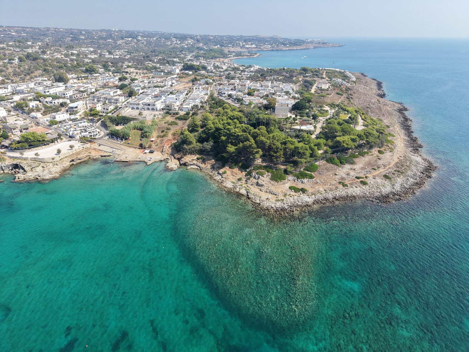
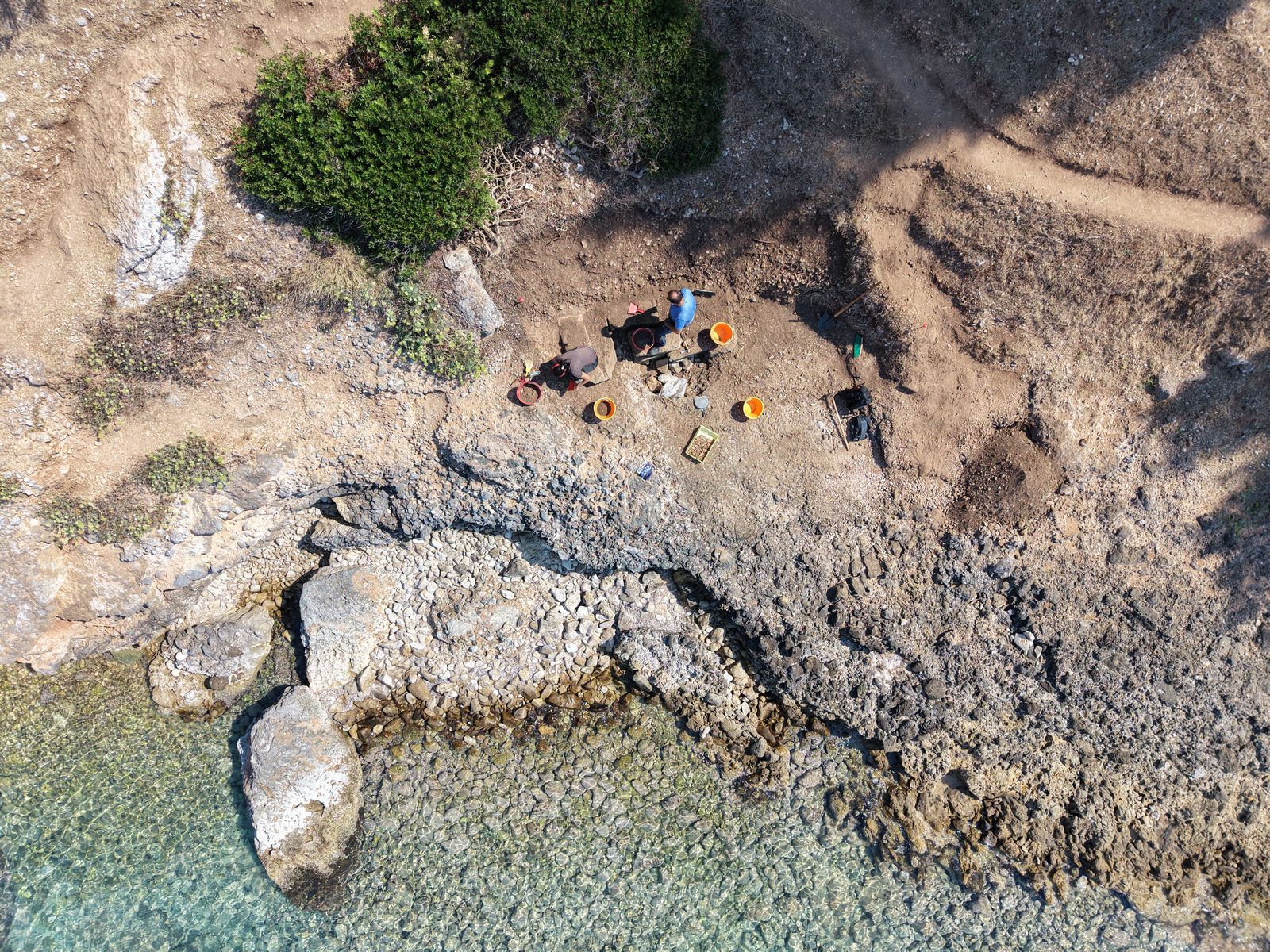
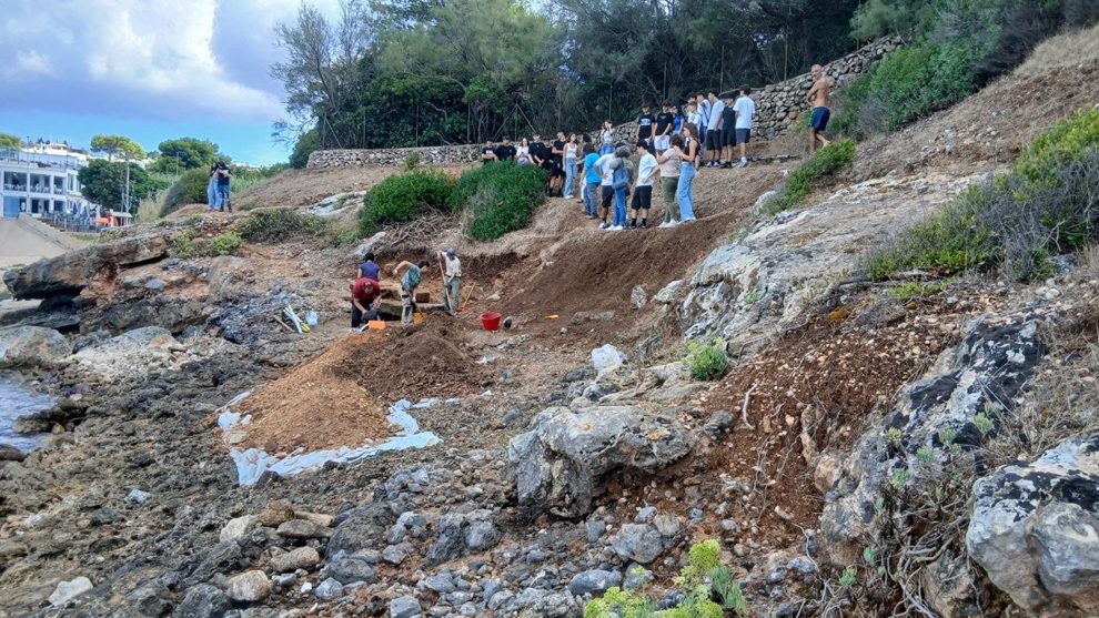
The main novelty of the second campaign was the extension of research to the coast, in the inlet of San Gregorio, traditionally identified as one of the landing places controlled by ancient Vereto.
The aim was to check on the ground structures partly already reported by the research carried out by Cosimo Pagliara in 1971, to understand their function better and to relate them to the overall organisation of the bay. The investigations had to deal with a particularly complex situation, marked by ancient stone-robbing, modern landscaping, recent works and strong erosion of the slope.
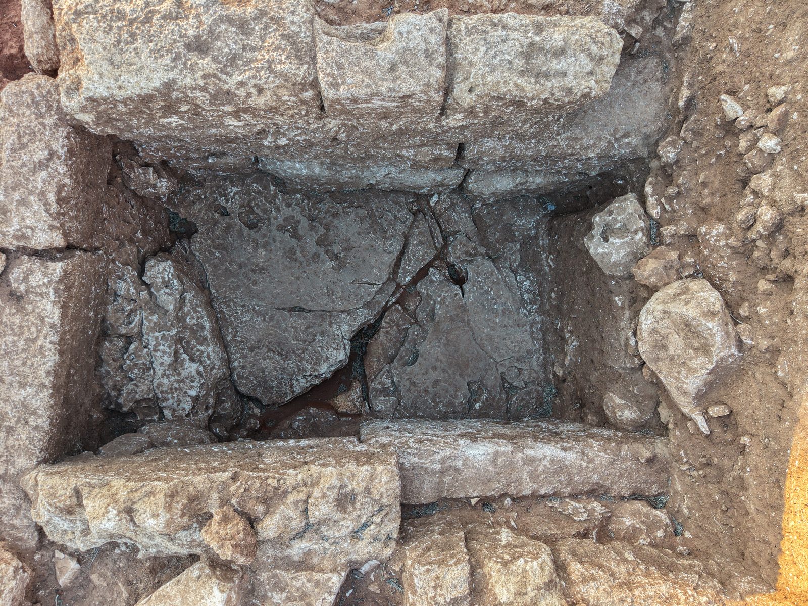
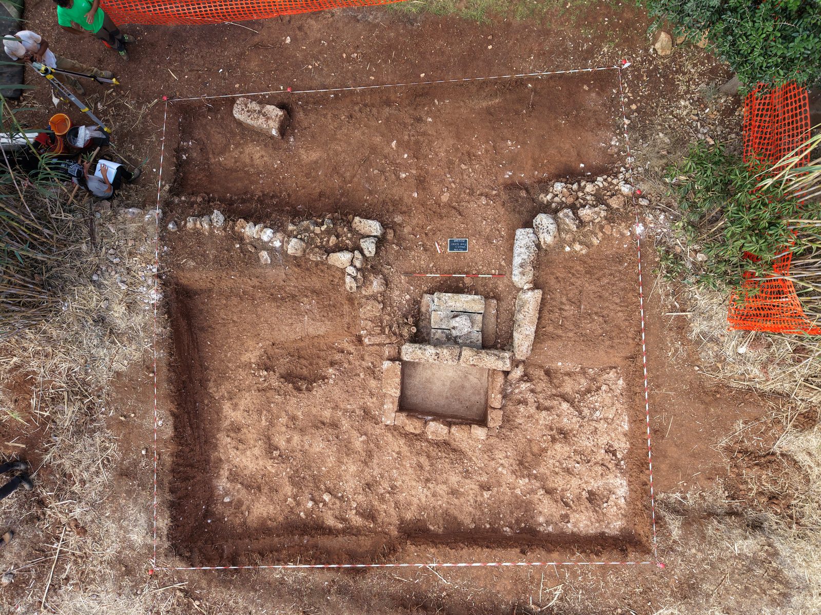
A first trench examined the area of an ancient well fed by the system of spring water that was one of the bay’s key resources. Around its mouth a horseshoe-shaped structure was identified, built of large calcarenite blocks and rubble. A little further south a quadrangular structure emerged, with a tough lime-based waterproof lining on its walls and floor. Its layout suggests a basin for holding water, perhaps a drinking trough, part of a wider water-supply system.
The investigation of the large block structure already identified in the twentieth century also proved particularly significant. The excavation made it possible to follow its continuation eastwards even where the blocks had been removed: its trace survives in the thin bedding of crumbled calcarenite on which the wall rested.
On the basis of the data now available, the structure is preliminarily interpreted as a ramp used in harbour operations and in loading and unloading heavy goods from boats. It is a hypothesis still to be tested by further investigation, but for the first time it makes it possible to begin reading the organisation of the spaces of the ancient landing place archaeologically.
A monumental slipway for boats
A third sector yielded evidence even more closely linked to the use of the coast.
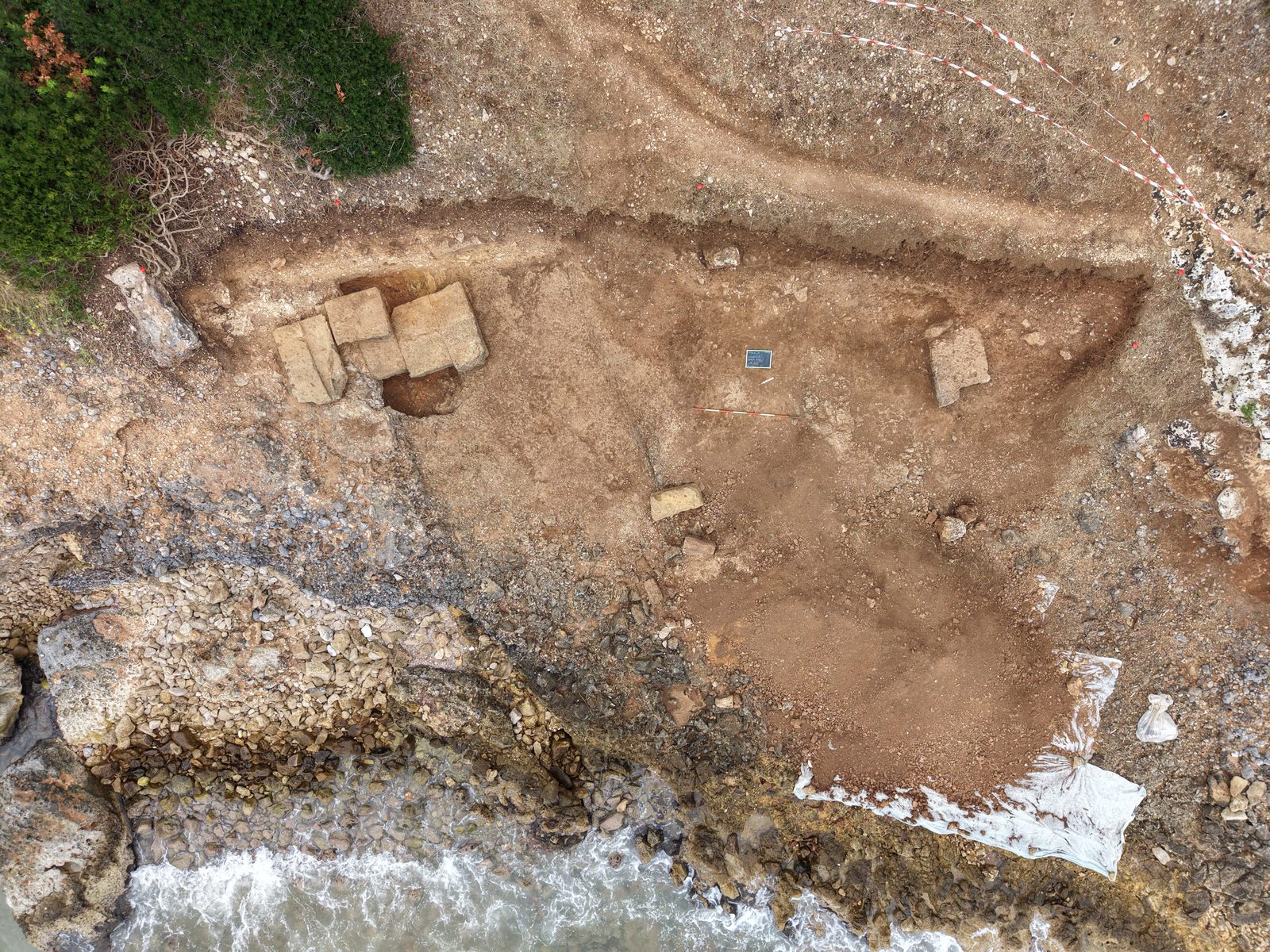
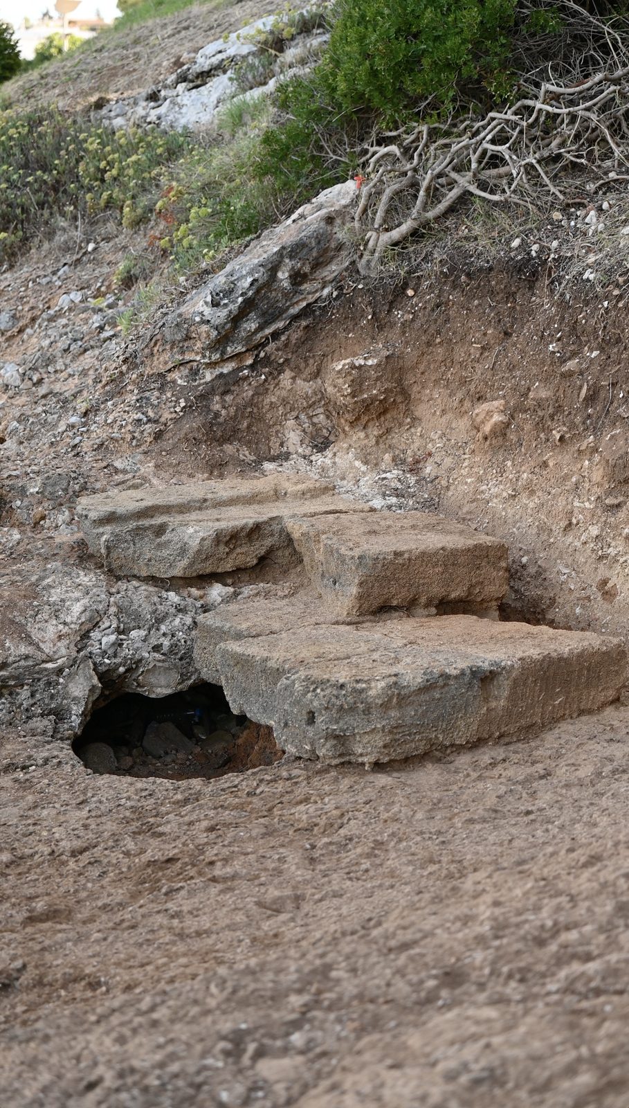
On the western side of the promontory, the bedrock shows an artificial cut forming a wide surface sloping towards the sea. Its shape has led to its interpretation as a monumental slipway for launching and hauling boats ashore, probably also reused in later periods as a ramp down to the sea.
The area also preserves large squared blocks and a stratigraphy heavily affected by wave action, by the collapse of natural cavities and by the slipping of the overlying soil downhill. For this very reason the finds recovered from the colluvial deposits cannot be considered in their original context, but they are still valuable evidence of the stratigraphy once present higher up the slope.
The finds include fragments of Late Roman amphorae, an oil lamp, two bronze fish-hooks, an as of Tiberius in excellent condition, a Byzantine follis and a coin preliminarily attributed to the mint of Ugento. Their chronological range confirms how long and complex the occupation of the bay was, and points to the presence, higher up, of layers of the Roman imperial and Byzantine periods that have now partly slipped towards the coast.
From the town to the harbour, then, a single system emerges: the hill of Vereto, the paths that led down to the sea, the water structures, the spaces for landing operations and the infrastructure cut directly into the rock. The second campaign has turned the relationship between the inland centre and its coastal outlet into a concrete archaeological question, one of the main lines of future research for Leucantica.
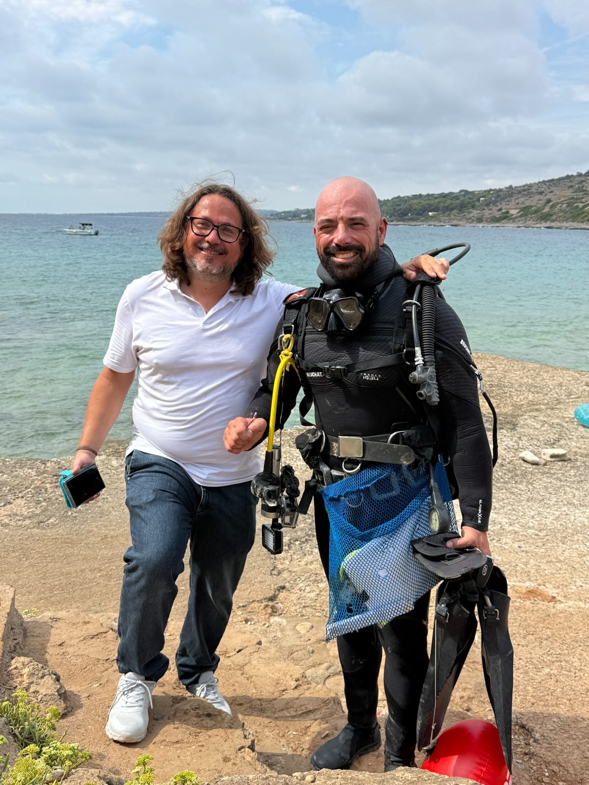
The coastal investigations could also count on the collaboration of Angelo Cossa for underwater surveys and recoveries, a particularly useful contribution for reading the inlet not only from the land but also in its maritime and submerged dimension, crowned by the recovery of three important stone anchor stocks and of some architectural elements still under study.
The involvement of citizens and of the community through the mission’s social media channels also made it possible to identify what probably still survives of the menhir of Patù, which disappeared in the early 1900s, and to solve the small puzzle of some Messapian letters added in modern times to the blocks of San Gregorio.
From the excavation to the Centopietre
From the outset DiscoVereto was conceived as diachronic research. Being archaeologists of pre-Roman Italy does not mean looking only for what belongs to the Messapian phase: it means following the layers without prejudice, down to the most recent transformations and to the building of the historical memory of the territory.
So it is not the study of the pre-Roman period that “happened upon” the Middle Ages by chance. It is the wish to understand Vereto as a whole that raised a new question: what happened in the territory when the ancient town gradually lost its form and its role? That question leads inevitably towards Campo Re, San Giovanni Battista and the Centopietre.
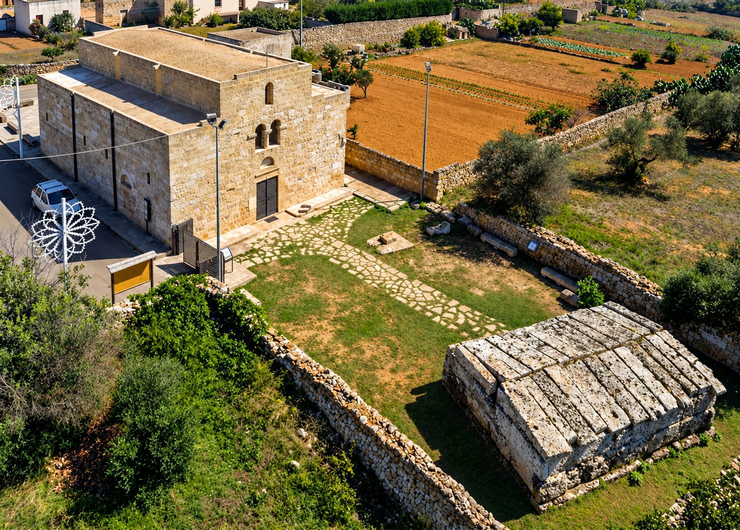
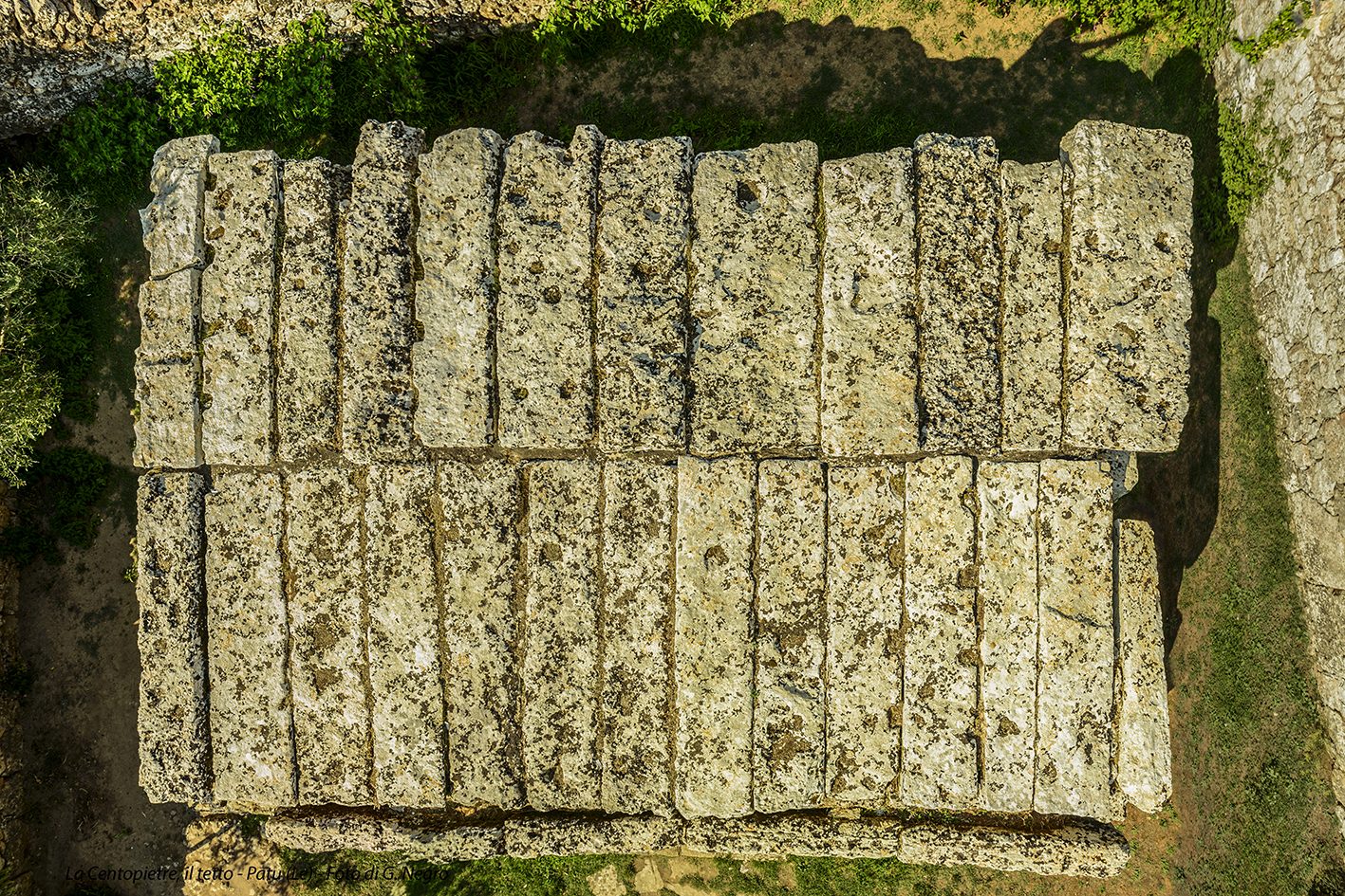
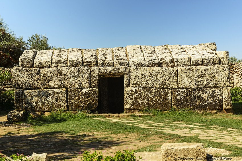
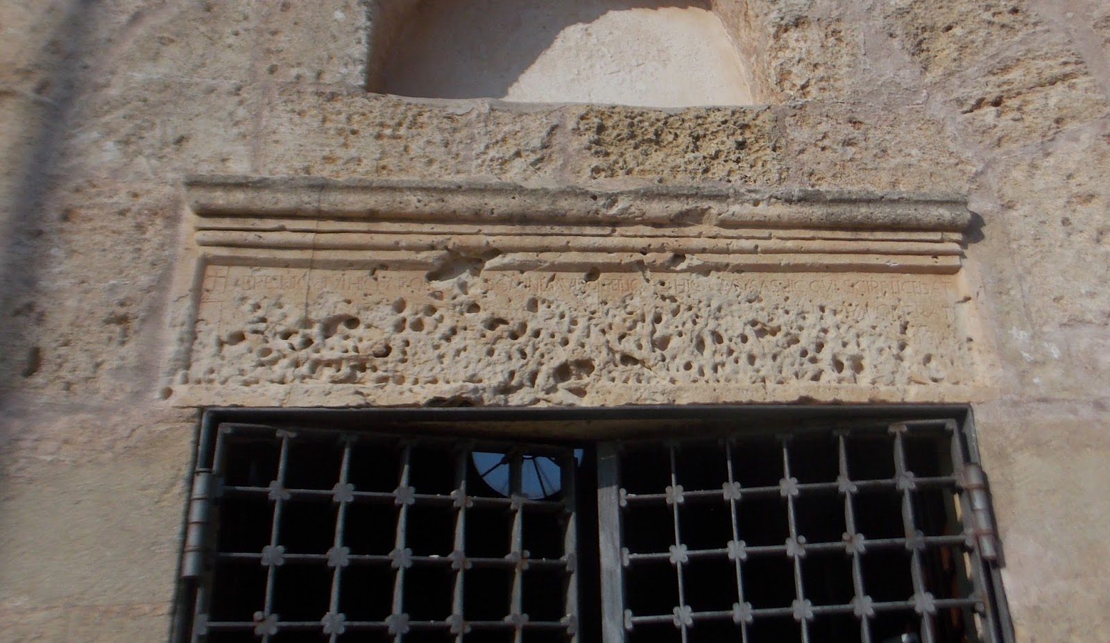
It is from this perspective that research also returned to one of the most enigmatic and debated monuments of the Capo di Leuca: the Centopietre of Patù, declared a national monument in 1875.
Once considered a megalithic, pre-Hellenic or Messapian building, the Centopietre is now recognised as medieval, although its precise date and original function are still open questions. Its very historiographical story shows how a monument can change meaning completely once it is freed from preconceived interpretations and brought back into the dialogue between archaeology, written sources and landscape history.
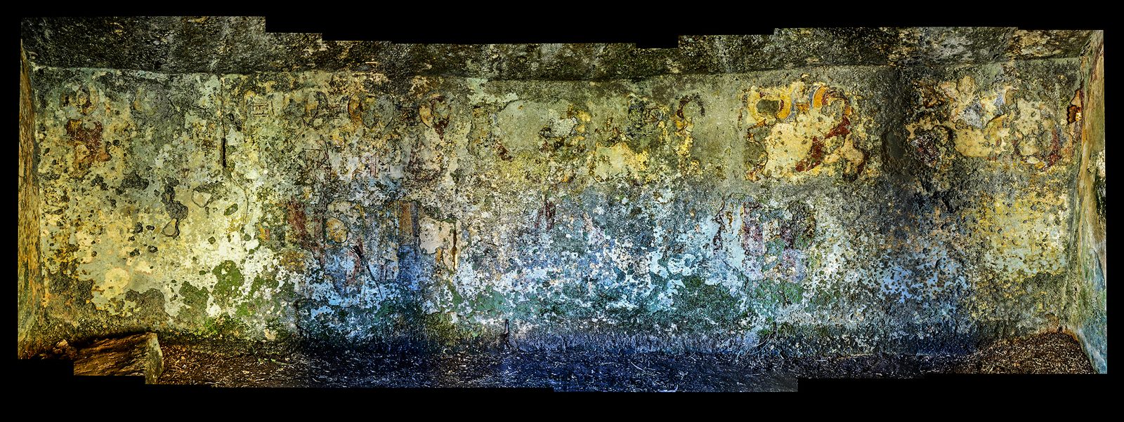
The research is bound up with an urgent conservation problem. The monument is now badly deteriorated, with the frescoes almost entirely gone and several roof slabs cracked or unstable. For this reason the Municipality of Patù, in agreement with the Soprintendenza, has started the process of compulsory purchase, with the aim of making possible a comprehensive programme of stabilisation, restoration and enhancement.
The finger of St John: from Patù to Altamura
The study of the Centopietre itself led to a closer look at a second story, apparently far from the excavation but closely tied to the building of the memory of the place.
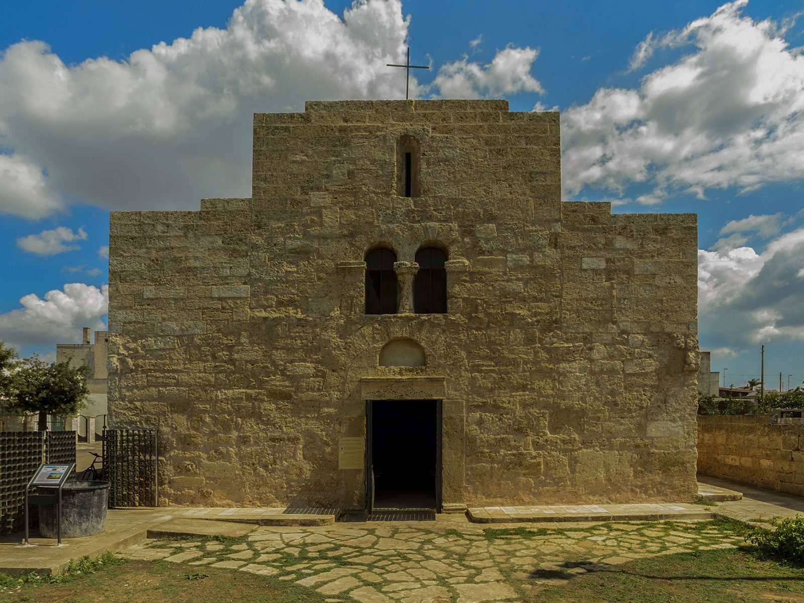
A tradition recorded in the sixteenth century recalled the discovery, in the nearby church of San Giovanni Battista, of a relic attributed to the saint: a finger said to have come from the Holy Land, to which local devotion attached particular importance.
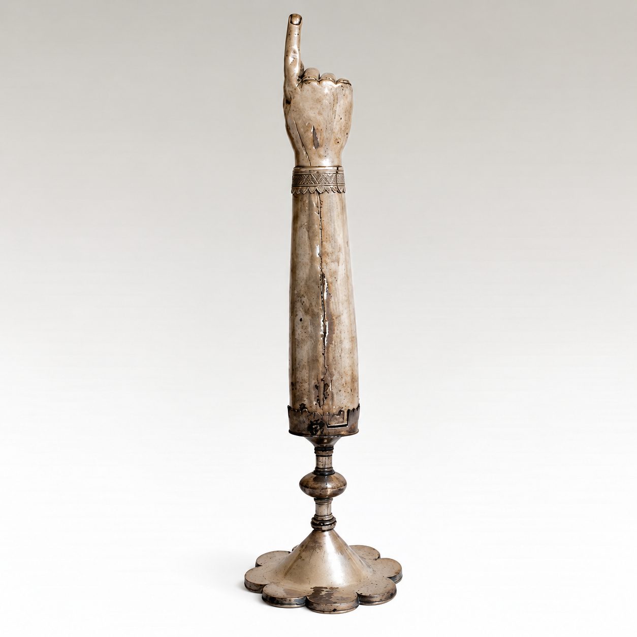
A finger inevitably recalls the best-known image of the Baptist, the one in which the saint points to the Lamb of God – “Ecce Agnus Dei” – and for this very reason it could take on extraordinary devotional value. All trace of that relic was later lost.
The research carried out by Valentino Nizzo has now compared sources from the Salento and from Altamura which converge, with a very high degree of probability, in identifying the relic once venerated in the territory of Patù and Leuca with the one still kept in Altamura Cathedral, inside an old arm-shaped reliquary. The relic is already documented in Altamura in the sixteenth century, and an independent Altamura tradition explicitly states that it came from Leuca: its arrival in the Murge town must therefore have taken place during the sixteenth century, and in any case before 1584.
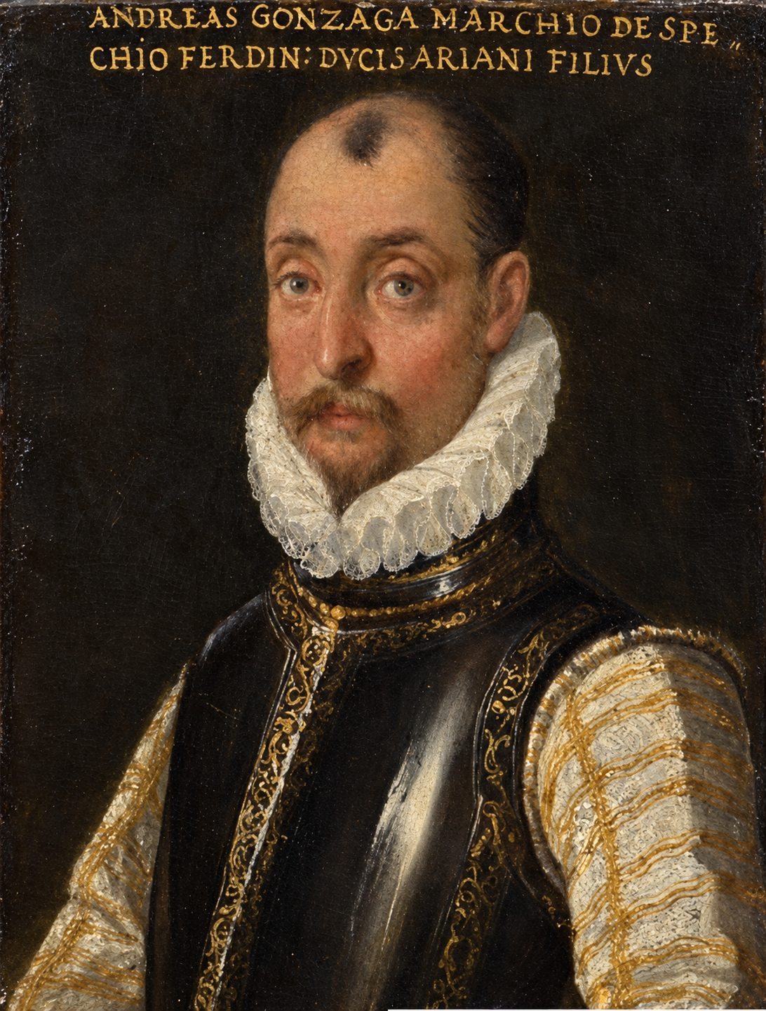
Who actually arranged the transfer remains to be clarified. The historical context, however, points in a particularly significant direction. In the second half of the sixteenth century Patù, Leuca and Alessano were under the lordship of the Gonzaga, while Altamura was ruled by the Farnese. The two families, at first divided by bitter disputes, were formally reconciled in 1560; in the following years relations grew closer, and the next generation saw Ottavio Gonzaga and Alessandro Farnese fighting side by side against the Ottoman Empire, up to the great stage of Lepanto in 1571.
It is therefore possible that the circulation of a prestigious relic such as that of the Baptist was also helped by these dynastic, religious and courtly networks, in which the exchange of relics could help to strengthen relationships, devotions and alliances. The available documents do not yet allow us to identify the intermediary with certainty, nor to establish the route by which the fragment reached Altamura; they do, however, allow the transfer to be placed in a historical setting far broader than previously imagined.
The Gonzaga court of Alessano itself was by no means culturally peripheral. Andrea Gonzaga had gathered around his court men of letters, scholars and men of culture, bringing the Capo di Leuca into the great aristocratic networks of sixteenth-century Italy. In 1587 the scholar Cesare Rao recalled the “virtuosi, letterati [e] gentilhuomini” at his court, calling him a protector and patron of men of letters. It is precisely in this setting, where local memories, devotion, chivalric culture and dynastic politics could constantly meet, that the more complex tradition of Siminiano and the Centopietre also seems to take shape in the same decades.
Siminiano, Charlemagne and the warrior saints of Europe
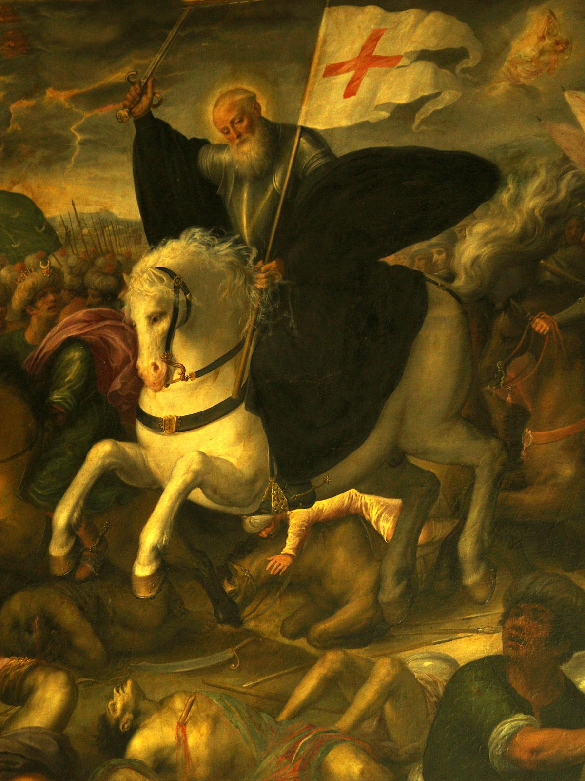
It is in the same context that the figure of Siminiano gains a new explanation: the mysterious knight who, according to a centuries-old tradition, fell fighting the Moors alongside Charlemagne and was buried in the Centopietre.
Charlemagne and his paladins did not fight at Patù. But in the sixteenth century the confrontation with the Ottoman world was a very concrete reality for the communities and noble families of the Capo di Leuca. At the same time, the great narratives of the Carolingian cycle, from the Chanson de Roland to the Orlando furioso and the Aspromonte, were a language shared by the courts of Europe.
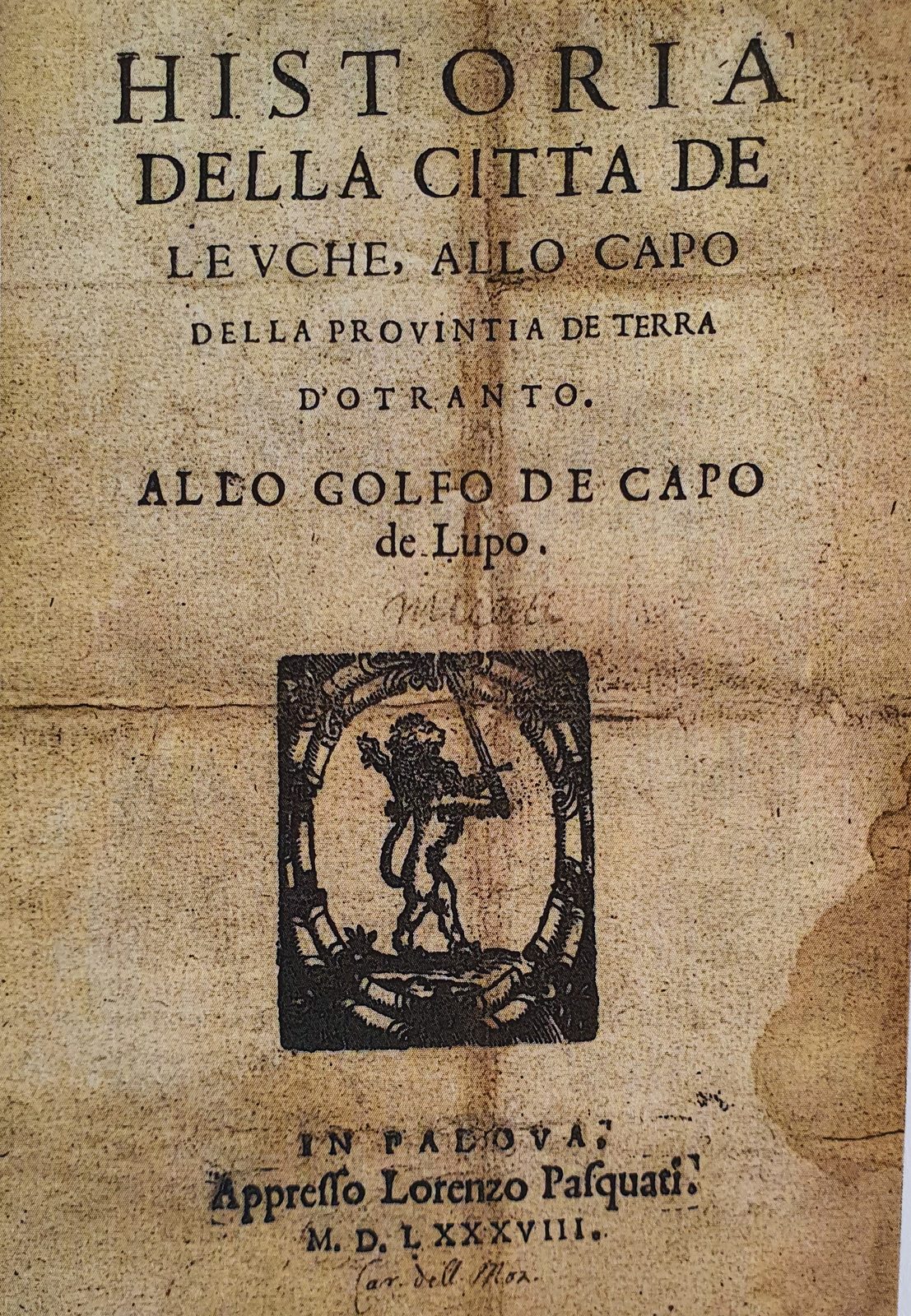
The evidence lets us watch the story taking shape almost live. The 1532 inscription of San Giovanni Battista already mentions a King Charles, the Moors, St John and the relics; it does not yet mention Siminiano, nor the identification of the Centopietre as his tomb. Only a few decades later, in the anonymous Historia della città de Leuche printed in Padua in 1588, does the story appear in its complete form: Charlemagne, Roland, the war against the Moors, the fallen knight and the “Cappella di cento Pietre”.
Comparison with European traditions has revealed significant parallels with the warrior saint Saint Émiland or Saint Milan, who fell heroically fighting the Saracens in the time of King Charles near San Juan de Luze and was buried in a monumental sarcophagus. His memory became intertwined with that of Similien, an early bishop of Nantes, and with that of Millán/Aemilianus de Cogolla, patron saint of Spain, venerated as matamoros together with St James. The near-homonymy between the place where he fell and the church of “San Giovanni di Leuche”, next to a monumental tomb of “cento pietre”, must, in the mindset of the time, have justified the appropriation of his identity and his transformation into the baron Siminiano, a reading confirmed by a wide range of clues.
The point is not to argue for the direct transmission of a single legend from Burgundy to the Salento. What is most interesting is rather the existence of a shared cultural language, through which enigmatic tombs, warrior saints, Saracens, relics and Carolingian material could be continually reinterpreted and adapted to different places.
Seen in this light, the Capo di Leuca no longer appears as a periphery. Especially after the Ottoman conquest of Constantinople in 1453, the sanctuary de finibus terrae had become the furthest reachable point of a pilgrimage route ideally directed towards the Holy Land. It was one of the ends of a great geography of European devotion and mobility: the so-called Via Francigena led pilgrims all the way to the Salento finis terrae and to the ports of embarkation for the East, while to the west the Way of St James connected France and Spain. The 1588 Historia de Leuche itself links Charles, the “camino di S. Iacomo” and the liberation of Leuca from the Saracens.
Over this religious network lay that of chivalric literature and of the Renaissance courts. The Gonzaga, lords of Alessano, were directly part of this world: Ferrante Gonzaga was the son of Isabella d’Este and belonged to the courtly circle in which Ariosto’s Orlando furioso had found one of its first successes; in the next generation Ferrante II Gonzaga would be in contact with Torquato Tasso. The story of the relic adds one more concrete element to this picture: the same dynastic networks could connect people, cults, objects and memories.
The “invention of tradition”
This is the broader meaning of the research: “invention of tradition” does not mean deliberate forgery.
The church of San Giovanni existed. The tombs of Campo Re existed. The Centopietre existed. A relic venerated as part of the body of the Baptist existed. The ruins of Vereto, the pilgrimage to Leuca and the very real fear of Muslim raids existed. And there were dynastic, courtly and religious networks able to link the Capo di Leuca with Altamura, with the great Italian courts and with the Mediterranean of Christian Lepanto.
In the sixteenth century these real elements were gradually pieced together into a story able to give them a single meaning. Charlemagne, Roland and the paladins provided the language through which to explain the ruins of a town, the tombs of a plain, a church, a relic and a monument whose origin had long been forgotten.
The legend therefore does not lose value once its origins are understood. It becomes an exceptional historical source in its own right, able to show how a society built its own past and placed an apparently peripheral territory within the great political, religious and cultural geography of Renaissance Europe.
Research that becomes community: training, schools and communication
The 2026 season was also an experiment in public and participatory archaeology. The site was not conceived as a space reserved for specialists, but as a place where research, training, conservation and public engagement went hand in hand.
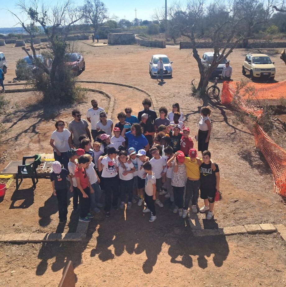
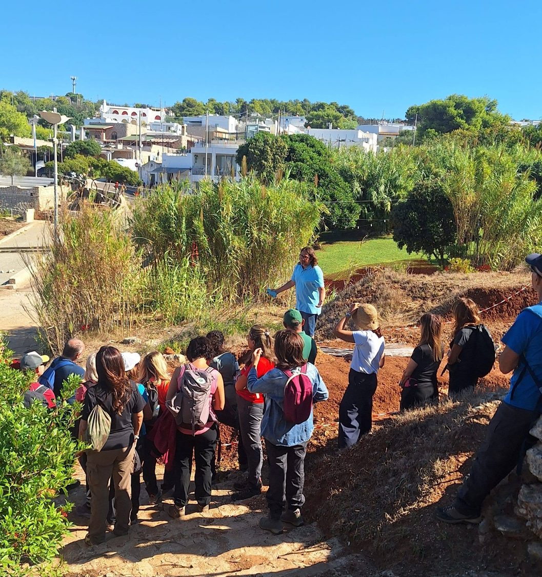
Throughout the ten weeks of work the excavations remained open to the community through guided tours, meetings with the archaeologists, educational activities and initiatives for schools; in September this experience was extended to San Gregorio as well. Already in the first campaign more than a thousand visitors had followed the progress of the investigations at close quarters, and 230 pupils from local schools had taken part in the educational activities. Across the two campaigns as a whole, visitors numbered in the thousands and school students of all levels in the hundreds.
Meeting schools played a special role: explaining the archaeologists’ work directly on site means making visible the step from object to question, from stratigraphy to interpretation and from discovery to protection. The curiosity of young people was an integral part of this experience, not an activity on the margins of the excavation.
The same approach guided university training. More than 40 students from L’Orientale and other Italian universities took part in the two campaigns, working in shifts in the different sectors of Vereto and San Gregorio. On the Leucantica website each participant is recognised as a protagonist of the collective undertaking: communication serves not only to present the results, but also to give visibility to the work, time and skills of those who contribute to the research.
This principle also applies to social media and video documentation. Communication was carried out with respect for the needs of heritage protection, trying to turn the speed of digital languages into an opportunity to bring the public closer to the method and not only to the exceptional nature of the discovery. Updates from the site, images, short in-depth pieces, interviews, talks and videos made it possible to follow the progress of the research almost in real time through Leucantica, the @DiscoVereto social channels and the @Etruschannel YouTube channel.
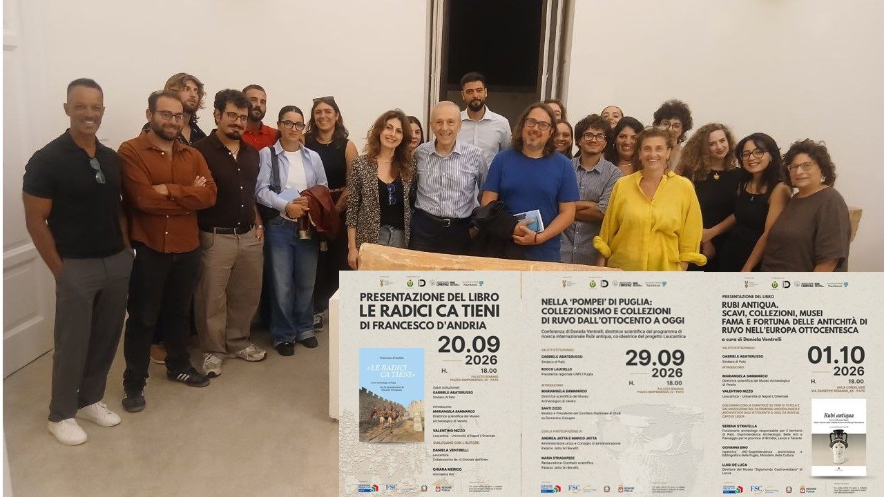
Public engagement also took the form of a series of talks and presentations curated by the archaeologist Daniela Ventrelli, co-founder of Leucantica, in collaboration with Mariangela Sammarco, director of the Archaeological Museum of Vereto. Between September and October the events brought the research on Vereto into dialogue with other themes and projects of Apulian archaeology, from the presentation of Francesco D’Andria’s book “Le radici ca tieni” to reflections on collecting and on the Ruvo collections, up to the presentation of “Rubi antiqua. Scavi, collezioni, musei. Fama e fortuna delle antichità di Ruvo nell’Europa ottocentesca”. The site thus lived on in the spaces of the museum and of public debate, extending the participatory dimension of the research beyond the excavation itself.
The aim is to share not only the final result but the research process itself: to show how an archaeological fact comes into being, why a hypothesis can change during excavation, and how knowledge is the first and indispensable tool of protection. It is from this perspective that DiscoVereto is part of the wider Leucantica project, which brings together fieldwork, the study of sources, landscape reading, digital technologies, training and community participation.
From public presentation to the next stages of research
The presentation of the results on 5 October at the offices of the Soprintendenza in Lecce, attended by the Soprintendente Antonio Zunno, the mayor of Patù Gabriele Abaterusso, Fr Gianluigi Marzo, Director of the Office for Ecclesiastical Cultural Heritage of the Diocese of Ugento - Santa Maria di Leuca, and Valentino Nizzo, was not an end point, but the first public account of research still in full development.
The results will feed into the new catalogue of the Archaeological Museum of Vereto, edited by Mariangela Sammarco, and into Valentino Nizzo’s contribution on the history of Vereto from its origins to Romanisation and on the building of its memory. The research will then be developed further in a monograph devoted to the Centopietre, the relic of St John, the birth of the tradition of Siminiano and the European parallels that emerged during the study.
Further fieldwork will instead have to test and refine the still preliminary interpretations that emerged at Vereto and San Gregorio: the date of the first protohistoric occupation, the layout of the Messapian and Roman structures on the summit, the Late Antique transformations, the relationship between harbour infrastructure, water systems and hauling areas, and more generally the way the ancient town organised the relationship between hill, territory and sea.
For the full article (in Italian): “Dalla leggenda alla storia della Centopietre”.
The discoveries of previous campaigns
Each excavation campaign has its own page, preserved as it was when the work ended. Explore the results of past seasons.